Sunday, February 21, 2010

Time In The Clouds

I've feared it, been fascinated by it, but mostly I've been curious about it. What would it really be like to fly a plane in the clouds for an extended period of time?

Yesterday I found out.

According to my instructor it was a "mild" IFR day. It was overcast at 1100 feet for many miles in every direction. The visibility was around six miles.

There was a stable air mass over northern California with light winds and little or no rain. The temperature at our proposed cruising altitude of 6000 feet was 2 deg. Celsius, so we would need to keep an eye out for ice. Prior to takeoff we had no idea where the tops of the clouds would be.


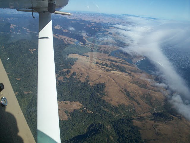
This was the sky prior to takeoff.

Normally I hate overcast skies but on this morning they had me grinning like a Cheshire cat. I would finally get a chance to fly in some real clouds!

The flight would depart from Santa Rosa (STS) to Sacramento Executive Airport (SAC). We would, hopefully, shoot the ILS Rwy 2 approach then probably go missed and return to STS.

I attempted to file two flight plans online with AOPA Internet Flight Planner. I had done this before with no problem at all.

This time I had problems. I wasn't sure how to file the route and I screwed up the first filed flight plan. Then it wouldn't let me delete the screwed up one and replace it with a correct one. ARGHHH! Then I tried to file the second flight plan (SAC to STS) and made another mistake here. Again, I had the same problem in that it wouldn't let me re-file a corrected plan. Now I had two screwed up flight plans filed with Flight Service.

I got further stressed knowing I was going to have to confess to my instructor that I wasn't even capable of filing a simple flight plan.

In retrospect, I got very stressed out over what was a simple and easily correctable problem. I mention it here because I need to learn not to let such a small issue affect my mental state. So - mental note - "It is very important not to let small, correctable, issues add to your stress level before a flight".  

The planned route to SAC in flight plan format was: 

Frees6.STS V459 SAC

These hieroglyphics translate into:

Depart Santa Rosa Airport - via the Frees6 Departure - back to the STS VOR - V459 airway - to the SAC VOR - land Sacramento Executive Airport.

I met my instructor at the FBO and I confessed my filed flight plans were screwed up. He suggested I call Flight Service and see if I could get it straightened out. I called 1-800 WX Brief and the briefer was very nice about correcting the problems. He didn't make me feel like an idiot and I appreciated his attitude.

Shortly thereafter we climbed in the plane, did the checks and called ground control. I asked if they had my IFR flight plan and then said they would check. A few seconds later they came back and said,

"34777 we have your clearance, advise when ready to copy."

With pencil in hand and paper in lap I say, "Go ahead, we're ready to copy."

The ground controller reads the clearance and I was pleased that I was able to keep up and write everything down. However, he had given us a departure procedure (DP) I couldn't accept (DME required which I didn't have).

I started to mention that we needed the Frees6 departure when my flight instructor interrupted me.

"Always read back the clearance first, then explain any issues with it", he says.

I read back the clearance and then ask for the alternate DP. The controller says "stand by" and we wait for just a couple of minutes before receiving the amended clearance.

We do our VOR accuracy check in the run-up area and with the DP in my lap, NAV and COM radios and OBS's set and heading bug adjusted for my first course, we're cleared for take-off.

At 1100 feet we enter the clouds. Even though I wasn't wearing the view-limiting foggles today I barely noticed the transition. I was still in a climb and I was focused on the instruments.

Finally, I lift my eyes for a quick peak. The view was solid grey/white and somewhat disconcerting. Then the "leans" set in.

The "leans" is the over-whelming sense that your body, and hence the plane, is most definitely in a significant bank. You get a strong urge to roll yourself and the plane "level". This, of course, would be a mistake since you aren't in a bank at all. It is the fluid movement in your inner ear that is telling your brain something that isn't true.

A check of the attitude and heading indicator verifies that you are straight and level but it takes some self-control not to get distracted by the feeling. Eventually it goes away, only to return at various stages through-out the flight.

We continue to climb up in the cloud layer and I start to feel more comfortable with the concept that I can't see out the window. At this point I am glad I have a good idea in my mind of where we are, where we are going and how we're going to get there. We have only basic VOR and associated "steam" gauges. There is no fancy GPS in 34777. We do have a 15 year old, three-inch round, Apollo 360 GPS which does help with situational awareness, but not much else.

After climbing in the clouds for almost 3000 feet we break out into clear blue sky. Again, I don't really notice except that it's much brighter in the cockpit all of a sudden. We're almost at Frees intersection and there is no time for even a quick peek outside.


After making the 180 degree turn at Frees and getting established on the inbound course to STS VOR, I finally take a quick look out the window.

Oh-my-freaking-gawd it is beautiful!

The gloomy, overcast day has magically turned into the brightest, sunniest, blue-est day ever! Below us is a solid and brilliantly white rolling layer of unbroken cotton that stretches as far as the eye can see.

The grin stayed on my face for a long time. In fact, I think it's still there.

We now had about 20 minutes of flight time before we would need to begin the set-up for the SAC approach. I really hadn't had such an IFR "quiet time" up until now. My previous flights had always been the rushed, procedure-to-procedure affair, that left no time to just fly the plane quietly. In reality, this is probably much more what a real IFR flight is like and I definitely enjoyed the time. 

All to soon ATC begins vectoring us to the ILS 2 localizer approach to Sacramento Executive Airport. Then we are told to descend to 2000 feet.

As we enter the clouds the turbulence becomes a little freaky. It is much stronger than our climb-out at STS. We're bouncing around and the damn "leans" set in again. I also, perhaps for the first time, begin to truly appreciate the ground. Perhaps I should say, FEAR the ground. As we descend through the clouds the realization that I am truly trusting my life to the instruments becomes very real. I try to put the thought out of  my mind and focus on flying the plane.

We intercept the localizer and I do an ok job of flying down the chute. We break out around 1000 feet and are cleared down to 700 by the tower and instructed to circle to land on runway 20. This was kind of new to me since I've never set up for a landing from 700 feet. I did all the normal stuff and the landing turned out fine.

My instructor needed to make a pee stop so we parking at the terminal building, did our thing and were soon on our way back to STS.

The flight was a confidence booster in that I felt that I had a good grasp of where I was, what I was doing and how to go about it.

Lessons Learned:
  • If there is a problem with the clearance, first read it back and then state the problem
  • Add wind direction and speed to my take-off checklist and memorize 
  • Add intermediate fixes to flight plan to verify wind and fuel consumption
  • File IFR flight plans on airways (if you don't have an IFR GPS)
  • Review alternate requirements (1-1-2-3: from one hour before to none hour after, 2000 foot ceiling, 3 miles visibility) and file an alternate if required - or even if conditions are close to requiring an alternate, since they may deteriorate.
  • Don't get stressed out over small stuff before a flight
  • Set up all the NAV and Com radios ahead of time. Use NAV 2 to aid with situational awareness if not otherwise required.
  • Have a heading and plan in mind for engine failure when flying on top of a solid cloud layer (know where the ridges or mountains may be hidden in the clouds below)
  • Double check your flight plans carefully before submitting them.
Gary

Sunday, February 14, 2010

Weather: Beyond the Clear-Air-Visibility-Unlimited Pilot

I've flown for twenty years as a very safe pilot. I know this because, well, not very much ever went wrong.

The other reason I know this is because during all that time I only flew when the weather was CAVU. In addition, I rarely flew farther than an hour from my home airport.

In all that time I never came close to running out of fuel nor did I have a close call with instrument meteorological conditions.

My flying experience was the result of a number of factors.The first was cost. I rarely had enough money to pay for more than a two hour flight.Secondly, I was renting aircraft and the scheduling problems and other limitations made it difficult to take a plane for a weekend trip.

Lastly, I was afraid. I was terrified of dying in an airplane crash.

Very early in my flight training I came face to face with the harsh reality of death in general aviation. Over a period of 18 months, during my private pilot flight training, seven people I knew died in five separate crashes.

Many years have passed and I now know that what I experienced was a statistical anomaly. At the time, however, I believed this frequent personal connection with flying and death was normal. I regularly read the NTSB reports and they seemed to confirm my conclusion.

I kept flying in the wake of all this death because every accident had been a result of weather or stupidity. In one case it was a combination of both. I simply told myself that as long as I avoided weather I would reduce my chances of dying significantly.

Trying to avoid doing something stupid was a little harder. There is so much to learn about flying that sometimes you don't know something is stupid until you've done it. Combine this with someone who has long history of stupidity, and this could be a problem for me.

Now, I am in the early stages of instrument flight training and am also a partner in a Cessna Cardinal.The IFR training has caused me to spend time learning about weather in much greater detail. The Cardinal has allowed me to take trips to places I wouldn't have dreamed of before. These two factors have clearly raised my chances of becoming another NTSB statistic.

So why the hell do it? Why not just keep piddling around in the airport's backyard on those calm summer afternoons? In this way I will drastically reduce my chances of something bad happening to me in an airplane.

The answer for me is, adventure. I want to go to distant and new places and see and experience the amazing world beyond my horizon. I don't know how I got this way and it probably doesn't matter.

As a result of my new knowledge, Linda and I made a flight yesterday that I would not have contemplated a year ago.

The flight was a short, two-leg from STS (Santa Rosa) to APC (Napa) to CCR (Concord). The stop in Napa was for Linda to handle a notary signing. At Concord we would play the nine-hole golf course next to the airport.

The weather forecasts the night before the flight suggested marginal conditions. Possible fog and broken to scattered low clouds. The temperature would be a balmy 60 degrees and the winds were forecast calm. A year ago I would have ended my hope for the flight the night before. A lot of clouds in the sky meant I wasn't flying. Now however, the flight was a "maybe".

I woke early on Saturday morning to clear skies over Cloverdale. While this was a good sign, I knew conditions at STS could be quite different. They were. Santa Rosa was LIFR with haze and two layers of low clouds. A quick check of surrounding airports, including Concord revealed some hope for the flight. Concord was CAVU. Napa was scattered at 1100. The central California valley was also CAVU. The STS forecast was improving to VFR by 11 am.

Now the flight had gone from a "maybe" to a "probable" assuming the forecast was correct. So Linda and I packed up our stuff and headed for the airport. 

At this point I did have doubts, and not just about the weather. Was I making an intelligent and considered analysis here, or was I just being stupid for trying to make this flight? What if things got worse once we were in the air? What if, what if, what if????? Do I second-guess myself too much? Not enough? How the hell do I know?

We got to the airport and the clouds at the south end of the airport were at 600 feet. At the north end, there were none. At this revelation I started thinking about a "special VFR" departure, even though I had never requested one.

I decided to load the aircraft and wait and see. Linda dragged out the golf clubs and the lunch cooler and began packing them away. I supervised, which is something I'm quite good at.

"Let's go to Starbucks and give the weather some time to clear," I suggest. Linda, with visions of low-fat crappa-latta mocha dancing in her head, quickly agrees.  

A half hour later the conditions over the airport have turned to VFR and we decide to make the flight.

As we climb out from STS we see a broken to over-cast layer en route to our destination.

It is important to note for those unfamiliar with the area that this is a very short flight to Napa, about twenty minutes.

The over-cast layer is covering perhaps a third of our route. Therefore the duration of the risk would be short. As long as the engine didn't die in the first five minutes we wouldn't have to worry about descending through a cloud layer into who-knows-what below. Nonetheless, I do make a mental note of the approximate location of Petaluma Airport somewhere below the deck of clouds. 

I would like to mention that there would be many an experienced pilot who would say to me at this point, "You, sir, are a pansy ass. If you stress over such a minor risk, perhaps you shouldn't be flying." It's possible they would have a point. On the other hand, I have no intention of quitting now.

  
Once we were over Sonoma Valley the cloud layer thinned out. We found ourselves amongst a spectacular display of beauty. Blue skies, soft cumulus and the welcoming green of Sonoma's wine country.


After Linda had taken care of business in Napa we took time out for an executive lunch. Homemade salad, bananas with a health food bar for dessert. We may fly around in an airplane, but Linda ensures we do it as cheaply as possible!   

Lunch over, we re-check the weather to see if conditions appear to be as forecast. Apparently they are, so we depart for the short 10 minute flight to Concord. A few clouds appear in the distance, while a thin stratus layer hangs far above.


I don't think these are rice paddies but they look like it.


On final for 1R, the clouds are no longer a factor. . However, I have no intention of forgetting about them. The dew point spread is within a few degrees and through-out our nine holes of golf I frequently scan the sky for any sign of building clouds.

You can see the driving range for the golf course in the bottom of the picture

After the game, we return to Santa Rosa in clear skies. My tentative steps into "weather" flying (yeah, I know - this is clearly NOT weather flying) have proven reasonable and safe.

I didn't run out of gas and I didn't die, so I guess I remain a safe pilot.

Gary

Sunday, January 31, 2010

The Art, Science and Lunacy of Holding Patterns

Art: The human effort to imitate, supplement, alter, or counteract the work of nature.
Science: Skill, esp. reflecting a precise application of facts or principles; proficiency.
Lunacy: Insanity, especially insanity relieved intermittently by periods of clear-mindedness.

If I have a common theme to this learning process it is the challenge of comprehension and retention. First you have to understand a subject and then you have to remember it. A seemingly simple mental process that constantly confounds me.

My wife and co-pilot has commented, "Gary, your problem is that you have this need to know EVERYTHING about a subject you're studying. Just learn what you NEED to know and move on. Otherwise, you will drive yourself crazy."

On one hand, she definitely has a point.

I don't need to know everything there is to know about the engine in my Jeep just to change the oil. I get that, though sometimes, I forget that.


Yet when it comes to the art and science of flight, I have a fear that NOT knowing EVERYTHING will kill me.

I have reviewed the subject of Holding Patterns many times in the past. So, when I approached the subject, once again, I was expecting a speedy review of that which I already knew. Once again, however, the limitations of my feeble brain became obvious.

I think part of the problem of learning any subject on flying is the limitations of any single source of material. I have found that there is no one book, video or learning tool that will teach you all you need to know on any particular subject. Holding patterns is a good example. I have reviewed the FAA Instrument Flight Manual, Rod Machado's Instrument Pilot's Survival Manual, The Instrument Flight Training Manual by Peter Dogan and various online sources dealing with holding patterns. Not one of these sources, by itself, clearly covered everything there is to know about learning holding patterns.

The following summarizes everything I have been able to document to date on the subject. The drawings I created using Autocad.  

Holding Patterns - The Important Stuff

Treat all lines as radials coming out of the fix and write them down
During any parallel entry the first outbound leg is flown on the non-holding side of the course

The outbound turn is begun at the fix

The holding course is the course on which the inbound leg is flown

The inbound leg is one minute long

The outbound leg is adjusted to compensate for the wind so that the inbound leg is one minute long

Abeam is the position opposite the fix where timing of the outbound leg begins

A standard hold is where all turns are to the right

Max holding speeds
  • to 6000 msl 200 kts
  • 6000 to 14000 230 kts
  • 14000 and above 265kts

The zone of ambiguity is the region close to the line that separates the To \ From areas. This is where the flag reads Off

The Cone of Confusion is directly over the station and widens with altitude

Use a 20 - 30 degree intercept angle if you over shoot the course

Say " turn time twist throttle talk " each time you cross the fix or 
turn inbound

Ask yourself which side of the fix you are on - holding or non-holding?

Holding Clearance includes:
  • The word "hold"
  • A direction to hold from the fix
  • The name of the fix
  • A course
  • Leg length
  • The direction of the turns
  • Expect Further Clearance time (EFC)


“Hold west of STS VOR on the 300 degree radial, one minute legs, left turns. Expect further clearance at 1800.”
Note that the statement to “hold west” is redundant. There is no other way to hold on the 300 degree radial. It is provided to help the pilot avoid holding on the wrong side of the fix.  
    After clearance is received:
    • Draw the fix
    • Draw the hold course with an arrow pointing to the inbound course
    • Draw direction of turn - standard is right hand and is assumed if no direction is mentioned in the clearance
    • Indicate the planes location in relation to the fix and visualize the entry. If a teardrop entry is required determine the initial heading
    Correct visualization is the key to mastering holds. This can be practiced on MSFS

    When orienting from a VOR mentally rotate the aircraft to the desired course on order to correctly interpret he CDI

    To determine correct hold entry first turn to the heading to the VOR or fix. Then mentally superimpose the 70 degree line on the heading indicator. For standard (right turns) the 70 degree line is counted from the right side of the HI. For left turns the 70 degree line is counted to the left of the heading (line slopes up from left to right)     Just draw the pattern on the chart and the 70 degree holding line into the pattern.

    Practice intersection holds

    Practice intersection holds with a single VOR (two are typically required) (equipment failure)

    Inbound leg above 14000 feet is 1.5 minutes.

    I created the following diagrams to help me review the various patterns both now and in the future. 

    The basic holding pattern and naming conventions:


    VOR indications from various points in the holding pattern


    The direct entry procedures


    The parallel entry procedures


    The tear drop entry procedures


     Gary Welch

    Wednesday, January 13, 2010

    Approach Briefing - Hi, my name is Gary and I'm a pilot....

    I am striving to learn to "brief" or prepare  for an approach while in-flight. On the surface this sounds simple. I can do it very easily while reclining on my couch with my feet up and sipping a cup of tea. I leisurely start to read the entire approach from top to bottom while making notes, or highlighting, as I go along. After a few minutes of concentration, note-taking and review I am quite ready for the approach. Yet accomplishing the same task while listening to air traffic control, staying on course and altitude while some of my aircraft systems are failing... well, I ain't there yet.

    Originally, I thought this was something you always did on the ground before the flight. I soon discovered that air traffic control, the weather and other factors will frequently require you to re-plan for a new approach while in the air. Understanding the published approach to an airport is critical to, well, survival. It is, therefore, important to have a clear system for preparing for an approach.

    The new FAA "briefing strip" that is published as part of the new instrument approaches goes a long way to simplifying this process. Here's a typical example:


    The new strip has not been updated on all approach plates. As I understand it, the new version is only created when a change to an existing procedure is required.  

    The new briefing strip attempts to group most of the critical data in a consistent format at the top of the approach plate. As a IFR neophyte I wish they had called it something other than "briefing strip".

    In my un-learned opinion, the "briefing strip" should be re-named the "partial briefing strip". The strip has some of the information for the approach briefing but certainly not all of the critical data. To my somewhat limited mentality, the term "briefing strip" just confuses the process of "briefing the approach". Why didn't they call it Bill or George, or anything but "briefing strip"???

    Of course the experienced IFR pilot will say, "Well, duhh, of course it doesn't have everything. You have to read the entire approach to understand everything."

    I understand that argument so I guess my problem is the confusion of terminology. For the uninitiated student pilot "briefing strip" and "approach briefing" imply similar functions. Yet to properly "brief the approach", you have to do a few more steps than just review the briefing strip.

    These steps include:
    • Decision height or minimum descent altitude
    • Minimum visibility
    • Missed approach guidance frequency
    • Any special notes or procedures noted on the approach plate
    • Review appropriate airspeed and flap configuration
    • Consider what you will want to do if you have to "go missed". ie: request another attempt or divert to an alternate.
     As near as I can figure from my research, the following covers all of the information that needs to be reviewed to fully brief the approach.

    Approach Briefing

    1. Approach runway (on briefing strip)

    2.Nav aid frequency (on briefing strip)

    3. Approach course (on briefing strip)

    4. Glideslope intercept/FAF

    5. Decision Altitude / Minimum Descent Altitude

    6. Timing

    7. Touch down zone elevation (on briefing strip)

    8. Runway length (on briefing strip)

    9. Landing Distance

    10. Airspeed

    11. Flap setting

    12. Missed Approach Point

    13. Missed Approach Procedure (on briefing strip)

    14. Where to after the missed approach - another attempt or divert to alternate?

    15. Procedure Notes

    The 6 "A's" of the Approach
    1. ATIS - get it as early as possible. This will tell you if you can expect to fly the full approach or if you will need to circle.
    2. Altimeter set - from the ATIS
    3. Approach Brief -  
      • How long? - approach timing - segments and missed approach time
      • How low? - minimums and segments
      • Missed approach - always PLAN to go missed
    4. Avionics set - Navs and Coms 
    5. Airspeed - fixed at final approach fix
    6. Align - verify final approach course

    I will update this if I learn of additional issues should be noted. Part of briefing the approach is being able to do it fairly quickly. Presumably, after some level of practice, a list such as the above should not be necessary. However, at my stage of learning I find this helpful to summarize the information I need to be aware of.

    Gary

    Friday, January 8, 2010

    A Rose By Any Other Name - Will Still Confuse the Hell Out of Me

    I have issues with the compass rose. It makes me feel stupid. I have no doubt that I am mathematically challenged and this may be the crux of my particular issues with the compass rose.

    The compass rose has appeared on charts and maps since the 1300's. The term "rose" comes from the figure's compass points resembling the petals of the well-known flower.

    In trying to understand my problem with the compass rose I believed the affliction was a lack of "situational awareness". That is, until I looked up the definition of the term. Wikipedia defines situational awareness as "the perception of environmental elements within a volume of time and space, the comprehension of their meaning, and the projection of their status in the near future." 

    Ok, that's generally related, but it doesn't clearly define the issue. In order to solve a problem it helps to define it first.

    I think a clearer term would be "directional awareness". I am not always certain where I am in relation to a fix and/or I cannot figure it out quickly enough for IFR flight purposes. I think directional awareness needs to be automatic in order to be a competent instrument pilot. It's almost as important to a VFR pilot as well.   

    At first blush the innocent looking compass rose appears simple and logical. Numbers 0 through 359 in equal segments around a circle. The numbers are divided equally, with 90 degrees one quarter of the way to the right, 180 at the bottom and 270 on the left. Or 36 segments at 10 degrees each.

    Yet if the compass rose is so simple why does my brain get twisted in a knot while trying to do basic instrument maneuvers?

    First off, and the part that kind of pisses me off, is that North is not North. Not where I live anyway (in northern California). North is North East. North is not "up the coast", it's heading is way over to what I used to think was the northeast corner of the state. That would be wrong though. It's the North corner of the state. The coast line is oriented northwest.

    Another problem more specific to flying is the changing perspective of the compass rose. On one hand, you have the compass rose of the magnetic compass (or DG). It's easy to comprehend, even for me. It displays the "heading to" direction. Simple, stupid - so what's the problem?

    On the other hand, you have the imaginary compass rose that is centered on your next fix. The next fix might be an airport, VOR, airway intersection or grandma's house. 

    When flying IFR it is critical for directional awareness to always understand your position "from" your next fix. If you have a moving map GPS, this problem is almost moot. I don't, so I need to come up with a system to maintain this "directional awareness". Probably a good thing to know even if you have a decent GPS.    

    In the comfort of my home office I can sit back and slowly do the math for a reciprocal heading.

    "Let's see, 44 degrees plus 180 equals, uhhh 224!" .

    What's the problem? Ok, but let's try another example looking for the reciprocal heading of 183 degrees.

    "Let's see 183 degrees plus 180 degrees equals, uhhh 363."
    "No wait, this time you add 200 and subtract 20. So 183 plus 200 equal 383 minus 20 equals, uhh, that's wrong too."       
    "Ok, with 183 you just subtract 180 so it's 3 degrees!".

    So, now, where am I in relation to the fix? Uhh, let me think...

    I thought it might help to create a compass rose that I could study that would clearly show reciprocal headings. After a few iterations I came up the following:


    I made multiple copies of the rose and placed one on my bathroom mirror, one behind my monitor in my home office and one behind my monitor at work. The rose has the normal compass headings on the outside circle and the reciprocal headings on the inner circle. Visually it allows an immediate connection to to the reciprocal.

    I try to memorize the reciprocal of a heading. It is slow going. The roses have been up for a year and I still don't have all the reciprocals memorized.

    I do understand that you can simply look at the aircraft's compass or DG and read the reciprocal directly from there. In my opinion, though, that's not good enough. Also it doesn't solve the whole directional awareness problem.

    It's one thing to know the reciprocal heading - and another thing to clearly visualize exactly where you are in relation to the fix.

    I started talking about this issue with my wife, and co-pilot, Linda this morning. After some back and forth we figured out that it would help if I started solving the problem by first imaging which quadrant from the fix I was in.

    "Let's see, if I'm on a 055 degree heading to an airport, that would put me in the southwest quadrant from the fix. Ergo, I am southwest of the fix."

    Eureka! It was an epiphany. If I could first place myself mentally in the correct quadrant, then I was halfway to directional awareness. Then as I began my reciprocal calculation I knew approximately where the answer would lie.     

    To summarize - to determine where you are from a fix you are heading to, first picture what quadrant you are in from the fix - northeast, southeast, southwest or northwest.

    Next calculate the reciprocal knowing the answer will lie within that quadrant from the fix.

    To do this, if the heading to the fix is between 0 and180 degrees ADD 180 degrees. Or ADD 200 and then SUBTRACT 20.

    If the heading to the fix is between 180 degrees and 359 degrees SUBTRACT 180 degrees. Or SUBTRACT 200 degrees and then ADD 20 degrees.

    Probably somewhere in my flight training a flight instructor taught me this and I simply forgot it. Or perhaps they should have and didn't. Or perhaps I should have figured this out myself a long time ago.

    The one thing I do know that works for me is simply writing down a problem. Once I start putting the words on paper, the problem and the solutions, have a way of crawling out of the darkness of my sub-conscious.

    Gary

    Wednesday, January 6, 2010

    My Second IFR Approach Flight


    My instructor suggested we do two approaches. We would fly the FREES6 departure from Santa Rosa (STS), then direct to Scaggs Island VOR (SGD) for the transition to the Napa Loc 36L approach. We would go missed at Napa, which would bring us back to SGD. Since SGD is one of the transition routes to the STS ILS-32, this would be the beginning of IAP number two.

    When I received my instructor’s email explaining the above lesson plan my first reaction was – “say what”? Trying to wrap my head around this plan sent synaptic fireworks off in my brain. I re-read his email in the hope that everything I had already learned would somehow fall into place. I hoped I would have an epiphany where all the complex ramifications would simply reveal themselves to me in a calming light of singing angels.

    It didn’t happen. I was gripped with a sinking feeling of self-doubt and angst.

    Hell, I have doubts about my ability just to fly the simple departure procedure. How can I even hope to learn everything I will need to know to fly this lesson plan? Even if I do manage to “learn” this on paper and MSFS, there is no way I’ll actually be able to fly it. At least not with foggles on, no moving map GPS and with ATC constantly yapping at me.

    “You are too stupid to fly IFR. Quit now, Gary,” said one of the voices in my head.

    I decided to begin with the flight plan. I know enough to realize that, although I will be doing only one landing, I will need to file two flight plans. I start up AOPA Internet Flight Planner and create the two flight plans. I include the various intersections, pick appropriate altitudes and print out the Nav logs, charts and flight plans for each flight. Now what?


    I decide to review each step of the flight. I print out the current version of the FREES6 departure procedure, the APC Loc 36L approach plate and the STS ILS 32 approach. I try to memorize as much as I can. After 30 minutes I find I can remember the names of the procedures but not much else. I decide a highlighter, identifying the important parts, might help me pick out the information quickly when I need it.

    Over the next week I fly all or parts of the plan on MSFS a number of times. Slowly I start to have some understanding of what’s involved. Yet, even with the pause button, I still get behind the plane. As the day for my flight approaches I comfort myself with the thought that, “Actually flying the plane will be much easier than flying the simulator”. Two minutes into the actual flight I realized the fallacy of that concept.

    I arrive at the FBO and proudly proclaim to my flight instructor that I have done my homework! I have a ream-and-a-half of print-outs, charts, flight plans, logs, full size approach plates, checklists and a 98 page DUATS weather briefing. It all fits neatly on my 81/2x14 clipboard along with my electronic E6B, post-it holder, tethered pencil and Johnny Quest flashlight. I’m thinking my instructor must be impressed, but for some reason his eyes seem to roll back into his head. Probably a touch of vertigo from his last lesson, I’m thinking.

    In the plane my instructor coaches me on how to request our IFR clearance from the ground controller. He advises me to be ready to copy the clearance. No problem. Since I filed the flight plan, I already know what the clearance is going to be, right?

    “34777 I have your clearance,” says ground control.

    “Go ahead”, I say calmly waiting for the familiar words to flow into my headset.

    “34777 is cleared to Napa via hjjkjlk;k, then tnfkgfke, sdfsd;lk, squawk fdk;fskd;f.”

    “What did he say? Did you get any of that?” I ask my CFII.

    “Yep”

    “But it’s not what I filed for. I haven’t studied that. I don’t even know what he was talking about,” I whine.

    “Welcome to IFR,” says CFII.

    “Did he say right turn-out on departure?”

    “Yep”

    “But that’s not a departure procedure or an low altitude route. How does he know I won’t hit a mountain or something else?” I ask, thoroughly confused.

    “Because it’s CAVU and I don’t have foggles on,” explains the CFII like I’m some kind of idiot. Not an idiot-savant, just a plain old idiot.

    We were radar vectored all the way to the localizer at Napa. This possibility had never even crossed my mind.

    From the moment we left the runway at STS I had absolutely no idea where I was. I was following the controller’s headings and altitude changes which seemed to come every thirty seconds. The mountain of paperwork, charts and paraphernalia I had carried on my clipboard became a serious distraction. There was too much stuff and I couldn’t find what I needed when I needed it.

    I tried to glance at my three-inch diameter, circa 1990, Apollo GPS to figure out where I was.

    “I’m lost,” I declare to my CFII after the radio is silent for a few moments.

    “Look at your GPS,” he says.

    “I am, but I don’t have enough time to look at it, think about what it’s telling me and still fly the plane,” I say.

    When we intercepted the localizer I still couldn’t grasp where I was and what I was supposed to be doing next. My instructor calmly spoon-fed me what I needed to know.

    I think that’s when I realized how much I still had to learn. I also realized the only real way to learn this was sitting in the pilot’s seat and trying to do it. I think this realization helped calm me down and I decided I would just do the best I could and let my flight instructor help with the rest.

    When we reached 360 feet on the final approach to 36L at Napa, my instructor told me to take off the foggles. The runway was in front of me and I could have made a normal landing. However, I felt no real elation since I knew that I had never really been in control of the approach. I was flying the plane without any sense of situational awareness.

    We called “missed approach” and began the turn to the Scaggs Island VOR. I had flown this transition route many times on flight simulator. I couldn’t use the same excuses I had for the radar-vectored Napa approach. I knew where I was now and where I was going.

    Unfortunately, that didn’t help me very much. I still felt like I was a mile behind the plane. I didn’t do too badly on the ILS. I was able to keep both of the needles from getting too far off center. The foggles came off at decision height and I was able to make a fairly normal landing.

    After the flight my flight instructor spend some time suggesting how I could minimize and simplify my cockpit organization. He gave me some words of encouragement as well. I felt he had bailed me out when I needed it, kept quiet when I didn’t and never got annoyed with my performance.

    In retrospect I learned a lot from the flight. I learned there is no substitute for actually flying IFR. I learned I need to practice the basics of instrument flight. I learned that an IFR flight is not something you can just plan in advance like a VFR flight. Somehow you have to have a general plan but still have the overall situational awareness to deal with the enroute changes from ATC. I learned I need to practice reading the GPS and picturing my location in relation to the waypoint.

    I have a very long way to go….

    Gary

    "Wrong" Way Takeoff

    Technically there is no "wrong" direction to take off at a non-towered airport. A pilot has the legal right to take off upwind, downwind and even against the flow of traffic in the pattern.

    Still - I was trying to land at Lampson Field (1O2) yesterday. This small airport was extremely busy, for some unknown reason, when Linda and I arrived.

    There were two aircraft practicing manoeuvers just a few miles from the pattern (why not move a little farther away??), two in the pattern doing touch and go's - and us entering on a 45. The frequency was even more congested because of 3 other airports with the same frequency all coming in loud and clear.

    So, one of the t&g's announces he's departing the pattern and another is turning crosswind for downwind and I'm turning downwind - and I hear another take-off call.

    Only I had a serious "perception" problem at this first call because it didn't register that this guy was planning on taking the runway opposite to the three aircraft now in the pattern.

    So, I do my pre-landing checklist and start my turn to base - and my wife says - there's a guy taking off on "ten" (not "one zero"). I'm concentrating on the descent and at first I don't get what she's saying - because I've been trained to ignore distractions at this phase of the flight.

    "What?", I ask?

    "There's a guy taking off on ten".

    Another second or two guys by while I try to figure out what she means? "Ten?", "What?".

    "There's a guy taking off in the opposite direction right towards us", she says quite calmly. And yes, she is an awesome co-pilot!

    I never saw him but I immediately turned away and flew out over the lake.

    Yes, the "wrong way" pilot had a legal right to take off on the runway opposite of the flow of traffic. Likewise, I have a right to call him a ___hole for doing it. There was no reason to do this other than his own convenience. He saved maybe two minutes of flight time. Yet, he most definitely created a safety hazard for the other aircraft in the pattern.

    At the same time, I made a serious mistake that almost almost became a link in an accident chain. I did not listen carefully and comprehend the departing pilots radio call. I heard what I expected to hear and not what he was actually saying.

    So here's what I learned from this:

    - I must listen carefully to every radio call (yeah, I know its painfully obvious). The point is NOT to listen for what you expect to hear - listen very carefully to what is actually being said. (Also obvious, but I'm trying to reinforce and remember this experience, ok?)

    - I explained to my wife and awesome co-pilot that it would help me in the future if she would call out runways as "one zero" and not "ten". For whatever reason the "ten" didn't immediately click in my brain but I think the "one-zero" would have.

    - no matter how busy the pattern is, always assume some ___hole is going to exercise his right to take off in the opposite direction.

    Even after twenty years, every flight is a learning experience.