I began monitoring the weather two days before for my planned first solo IMC flight. The forecast for STS and CCR were indicating surface temperatures in the high 50’s, ceilings between 500 and 1200 feet and a slight chance of rain. I continued to follow the weather on Friday which indicated little change.
Saturday morning I awoke to overcast skies with some fog, but no apparent rain. I checked the METARS and read:
KSTS 301853Z 20004KT 10SM BKN005 OVC 009 13/12 A3020 RMK AO2 SLP219
KCCR 301853Z 19008KT 10SM OVC 012 13/10 A3020 RMK AO2 SLP217
The forecasts for my time of departure were:
TAF KSTS FM301900Z 28004 P6SM BKN010 OVC020
TAF KCCR FM301900Z 28008 P6SM BKN010 OVC015
I was planning on the VOR19R approach at Concord which has minimums of 640/1. My plan for the return to STS was the VOR32 approach with minimums of 700/24. I also planned for KSAC as an alternate and it was showing VFR with minimums well within the selected VOR 2 approach.
There were no AIRMETS, SIGMETS, TFR’s or significant NOTAMS that would affect the flight. Icing levels were up at 12,000 feet, well above the 5000 feet maximum altitude planned.
There were three cloud top reports. Two showed tops between 2000 and 2600 with one report indicating tops of 5000. At the time I placed little weight on this last report of 5000. As the rest of the flight conditions were favorable for my flight, I did not perceive this one possible negative as significant.
The 5000 foot cloud top was significant because I had no intention of making the entire flight within the clouds. My filed enroute altitude was 5000 feet so a cloud top of 5000 might leave me in the clouds. I knew I was not ready for this. This was a “baby steps” flight where I would climb through a thin layer, fly on top until my destination, then descend through the layer. When I reached the MAP, I would go missed and repeat the process back to STS. Baby steps.
My planned departure time was 12:30 local. I arrived about 45 minutes early to find significant haze and a slight drizzle over the airport. The AWOS was now reporting 500 SCT and 1200 OVC with a visibility of 2 miles. My only option for an approach back to STS required a 700 foot ceiling. I made a quick decision – no way was I taking off in this. I headed for the nearby Starbucks to wait for conditions to change.
I returned to the airport about 45 minutes later to find scattered clouds with lots of blue sky. This was a little disappointing. While I had wanted the weather to be a little better, I did not want it this good! I became a little frustrated that my flight would no longer involve actual IMC conditions.
I had completed the pre-flight prior to my Starbucks trip so 777 was ready to go. The plane fired up on the first try and, after setting up the GPS for the departure procedure, I ran my checklist, got the ATIS and called ground control.
I've received my taxi instructions with the comment that my clearance was “on request”. “On request” meant that the tower had contacted Oakland Center and were waiting for their response.
My VOR check was out of date so I pulled into the circle and “tuned and twisted”. Both VOR’s were within intolerances and I made the appropriate notation in my kneeboard.
Ground called and notified me that my clearance was available. I replied, “Ready to copy,” and the clearance came, “Cleared to Concord airport via Frees6, Skaggs Island transition, Victor 108, Croit, direct Concord, maintain 5000, squawked 4213, contact departure on 127.8.” The clearance was exactly as I had filed it, which was both unusual and welcoming.
After completing the pre-take off checklist and noting the time I was cleared for takeoff on runway 19. I pushed in the power and began my adventure.
The scattered clouds bases were around 900 feet. In just a few moments the white fog rolled over the aircraft and I was in instrument meteorological conditions (IMC).
The extended runway center line was very close to the Frees6 course so I made a slight adjustment to 202 degrees and reminded myself to keep the scan going in the climb. It felt good to be in the clouds at last!
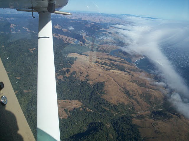
At approximately 2000 feet I broke out on top and was surprised to see a solid cloud deck above me. This was a little disconcerting as I was expecting to be in the clear. A few seconds later my climb took me right back into the clouds.
I was at 4000 feet, and still in the clouds, as I made the climbing turn at Frees and rolled into the 099 degree heading for Skaggs Island VOR. I could see the bright glow of the clouds above me and kept expecting to break out at any minute. It didn't happen. As I leveled off at 5000 feet I was still in solid IMC.
My initial elation at being in the clouds now turned to anxious discomfort. Adding to my discomfort was a strong need to pee. This problem would continue to distract me throughout the flight.
About 2 minutes into the Skaggs Island VOR leg I received my first course change. “Cardinal 34777 turn right heading 180 for traffic,” called Oakland Center. I acknowledged the call and initiated the standard rate turn while adjusting my heading bug to 180 degrees.
Although I should have been prepared for it, this course change meant I would not be flying my filed route. The fact that I no longer knew exactly where I was going added another stressor to my anxiety.
I had done all my IFR training using dual VOR’s and an antiquated Apollo 360 GPS. The old GPS had died a few days before my flight. I told myself this would not be an issue since I now had a large screen, IFly GPS. The IFly had the current low altitude charts, as well as geo-referenced approach plates, and a bunch of other bells and whistles. I soon discovered that, while the GPS has the capability, the pilot had no practice in using the system on an IFR flight.
Then my IFly shut itself off. Crap! I didn’t need this distraction now. I had been flying VFR with the GPS for a while and it would occasionally shut itself off if the power cable was bumped. In VFR conditions this was just a minor hassle. Already just a little uncomfortable, this added to my building anxiety. I bumped the cable again and it came back on, but I would now have to reload my approach and adjust my zoom scale.
The turbulence in the clouds was taking all of my concentration just to keep the plane level and on course. I struggled with the GPS during quick peaks away from the gauges. I could not get a zoom level on the screen that I was comfortable with. I did not have the screen set to display the critical data I had relied on from the old GPS. I decided that this would be too much of a distraction and decided to just “fly the plane” and follow Center’s directions.
“Cardinal 34777, clear direct to Skaggs Island then as filed,” came the next directive from ATC.
I later learned from GPS records that I was over the southern tip of Tomales Bay. I verified that NAV 1 was set to Skaggs Island and the OBS needle was centered on 080. I rolled into the turn and reset the heading bug to 080 degrees.
I had now been in the clouds for 20 minutes and my anxiety was deepening. This was no longer fun. While the turbulence was light it was enough that it required constant adjustments of pitch and bank. The sensation of the “leans” was ever present and I struggled to ignore it. The “leans” is the very real sensation that the plane is leaning to the right or left, even though the gauges are telling you that the plane is straight and level.
I started talking to myself. I reminded myself that I knew how to do this and I just needed to stay calm and “fly the plane”. I occasionally took deep breaths to help quell my nervousness.
Just after crossing Skaggs Island VOR I began to receive a series of course and heading changes from air traffic control. ATC also advised that I would be flying the LDA 19 right approach. I was not expecting this approach. I had a briefed the VOR 19 right approach. I struggled to find the hard copy of the LDA plate while complying with the ongoing course and altitude changes.
I found the plate and tried to brief it with quick glances. I knew I was getting close to the approach course and set the NAV 1 for the 108.5 localizer frequency.
At this point an experienced IFR pilot would be wondering two questions. Why didn’t I ask for a higher altitude to get above the clouds and why didn’t I ask for the approach I wanted? Good questions, for which I have no answer.
I broke out between layers momentarily as I identified the station and twisted the OBS to the approach course of 181 degrees. Almost as quickly, I was back in the clouds.
I now attempted to load the LDA approach into my GPS. While I was doing so Travis Approach directed, “Cardinal 34777 turn right to 150 degrees to intercept approach course, maintain 3100 until established, cleared LDA 19 right approach. Contact Concord tower.”
“Crap.” I was at 4000 feet and needed to make a descending turn while watching the CDI for movement. There was no time to set up the GPS, so I returned to flying the plane. I called the tower and told them I was inbound. They told me to report the outer marker. There was a 20 to 30 knot cross wind blowing and I was having trouble intercepting the course. Finally the CDI started to move just as I reached my clearance altitude of 3100 feet.
When the needle reached half scale deflection I begin my descent down to 2500 feet. It suddenly dawned on me that without a GPS indication I did not know how far I was from the airport. This realization ratcheted up the stress level further.
I was still getting bounced around in the clouds when all of a sudden I broke out into clear air between layers. I look to the left and saw what I thought was the general area of the airport. I immediately became concerned that I was off course. Then I looked at the CDI and it had swung all the way to the right. This was the opposite direction of where I thought the airport was!
“How could this be?” I asked myself. Something was wrong and I did not know what. I looked ahead and saw that I was about to enter a large, ugly, dark grey, billowing cloud. I was mentally overloaded. The anxiety level had increased and I was behind the plane. I was no longer in full control of my aircraft. I had lost situational awareness.
The thought came into my head that, “If you enter that cloud, you may slam into the mountains that are just west of the airport. You could kill yourself.” I had had enough. I made a decision that I was not going back into the clouds. I immediately made a left hand turn to remain in the clear.
I turned NAV 1 to the Concord VOR, centered the OBS, and called the tower.
“Concord tower 34777 is confused. I am going missed and I would like to open my flight plan back to Santa Rosa,” I said. The tower replied, “Cardinal 34777 contact Travis Approach on the 119.7.” They did not ask for further details as to why I had broken off the approach.
I flopped the COM 1 back to Travis and requested they open my flight plan to Santa Rosa. Although I had previously informed Travis that I intended to go “missed” on the approach, the controller seemed surprised. This was probably due to the fact he could see on his radar that I did not fly all the way to the missed approach point.
“Cardinal 34777, did the tower hand you back to me or did you just switch frequencies?” asked Travis Approach. I confirmed that the tower had handed me back and was told to stand by for my clearance.
A few seconds later they called back with my clearance which was, “as filed”.
I was still in the clear as Travis Approach advised that they would be vectoring me in a large circle for about 10 minutes, for traffic. The circling vectors they gave me kept me clear of the clouds, which were all around and above me. This gave me time to calm down and was the best thing that could have happened at the time.
As I completed the circle, and with a new confidence, Travis gave me a vector and altitude of 5000 feet.
I turned to the new heading and in a few seconds I was right back in the clouds. I immediately called Travis and ask for a higher altitude. “Cardinal 34777 climb and maintain 6000,” came the response. A few seconds later I was on top again and pleased that I had finally thought to ask for an altitude that would keep me out of the clouds.
I immediately briefed the VOR 32 approach, set up the radios and got the Santa Rosa ATIS. I felt like I was back in control again. I knew I still had to descend through two cloud layers but I no longer felt the same anxiety. The VOR 32 approach was simple and familiar.
I completed the flight without further problems.
(Notes: I later learned the IFly GPS was defective. I had it replaced and have had no further problems with the inadvertent shutdown.
On the approach to Concord when I thought I was off course due to the OBS needle deflection, I wasn't. In fact I was on course, and over the VOR, which explained the needle deflection - duhhh!)
Here my flight path from my GPS over-layed on Google Earth:

Lessons Learned
What I Did Right
1. Did a thorough flight briefing by using my briefing form2. Delayed departure until weather improved
3. Did ground instrument check and VOR check
4. Used checklists throughout the flight
5. Made a conscious effort to stay calm and fly the plane
6. Did not enter the cloud at Concord when I was uncertain of my exact location
7. Regained my calmity after Concord and was able to fly the return leg okay
8. Recognized I was over stressed and made an intelligent decision to stay in the clear until I sorted things out.
9. Asked for a higher altitude on my return route to get me out of the clouds
What I Did Wrong
1. Did not get in updated weather briefing before departure. Recent pireps may have informed me of the second cloud layer2. Drank coffee before takeoff which made me have to pee
3. Failed to recognize the importance of the inoperative old, but familiar, GPS
4. Unprepared to use the new GPS for IFR flight
5. Failed to ask for an altitude that would get me out of the clouds on the leg to Concord
6. Lost both situational and geographical awareness
Things To Do To Avoid Similar Problems In The Future
1. Set up instruments on the IFly for IFR flight2. Find a zoom scale that works for IFR flight on the IFly
3. Find a way to preset expected waypoints on the GPS that will still be valid even with ATC course changes. For example key VOR’s, departure point and destination point.
4. Ensure you place equal weight on all pre-flight data. Just because one piece of data doesn't seem to fit, doesn't mean it's not true.
5. Always get an updated weather brief prior to departure and ask for pireps
6. Do not drink coffee or other liquids prior to departure.
7. Do not delay asking air traffic control for a different altitude if you are unhappy with the current one
8. Don’t be afraid to ask for vectors if the workload is high and “own NAV” may overload you
9. Don’t be afraid to change IFR route or clearance in the air if something does not feel right. Just tell them where you'd like to go and let them help you.
10 You can always cancel IFR if you are in the clear, sort yourself out, and then ask for a pop-up clearance to get to a nearby airport.
11 Make sure you brief all of the possible approaches at your destination and have IAP’s available
Thanks Gary - this is a great read. I fly out of Gnoss and am familiar with all of the landmarks, though I haven't flown the VOR approach into KCCR.
ReplyDeleteWhat a fantastic examination of your flight - what went wrong, what went right. Congrats on staying calm and flying the plane.
Thank you for sharing this. It's a really helpful reminder that we can all learn from!
Glen